|
||||
| We begin from a
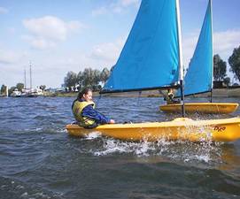
focal point that is familiar to all locals where the fresh water
from the Mill stream meets the sea at the Sailing Club. We
then wend our way northwards through the heart of the village and into the open
countryside beyond. We hope you enjoy the tour and
particularly that you might take time to view some of the
hidden places not often (if ever) seen by many.
Suggestion: if you prefer to follow the tour as the water flows from North to South, scroll upward from the bottom of the page. |
||||
| Where the Mill stream
meets the Sea.
After it's journey from the South Downs, having been supplemented by springs, fields and ditches along the way the freshwater merges with the sea via the old mill gate underneath the Sailing Club or, in the winter, via Colner Creek (see below). When the club gate is closed it pours gently over a mini-sluice to one side. The outward flow: |
||||
|
||||
|
||||
|
||||
|
||||
| Now we have reached the central point of the Mill stream by the Hotel of the same name. Next we'll continue our journey northwards toward the open countryside in a mo. However, it is worth noting at this point that many houses border this part of the stream and I'd like to illustrate the dangers of fly-tipping garden rubbish in this area. Fly-tipping is a criminal offence and it is my unpleasant duty to bring prosecution against anyone we catch doing it (which is partly why I'm called a "bailiff"). | ||||
| We move
onwards....
|
||||
|
||||
| Now for a slight detour to
the east and south.... This is one of the most extraordinary
phenomena in the water system.
The picture you see below "the Leat" draws water from the
Millstream and then flows under several houses for about 120
yards and enters the road drainage system where, for another
220 yards or so it flows toward the lowest point in the
central part of the old Village at the former Service
station. It then enters a large pipe flowing into what is
known as the Central Water Way (classified officially as a
Main River). This flows through the Ponds at Benedicts and
the Burial Ground and runs south to the Trippet. All
rainwater that falls between Delling Lane and The Millstream
Hotel escapes the Village via this route. It is a critical
point. |
||||
|
||||
|
|
||||
| So...
heading north once more under the Critchfield
Rd bridge at the top of Brook Avenue: |
||||
|
||||
|
||||
| The danger
of blockages upstream: The combination of the two blockages seen above (right) being close together could create a serious problem. If the build-up were allowed to continue: a) in the summer it could cut off a large quantity (perhaps all) of the water from the Village and; b) in the winter it might create a dam, causing flooding across the cricket pitch and into the houses that border "Green's Field". As I write the situation is being dealt with. The field owner has "riparian duties" to clear the tree and the poor old water bailiff (me) will probably have to remove the crate that some yob hoiked in there! Security note: Some of the places shown en-route are private and so for security reasons only the publicly visable locations are identified. One of the reasons I have produced this tour is that all locals and visitors alike may "virtually" enjoy seeing these "hidden parts". We hope you've enjoyed it. Visitors & locals alike: please take note of the dangers: We should warn you that in some parts of our waterways there are significant dangers. These include: deep sticky mud, broken glass, steel spikes, force of water flow - to mention just a few. Please do not attempt access. It is perhaps worth noting that it is these waters that took the life of the daughter of one of the last Saxon Kings of England [Canute] and over the years it has not lost it's dangers! We cannot accept liability or responsibility for your actions. Further tours of other important areas will follow soon. Thanks for looking!
|
Waterways tour
|


